In the current Crossfire campaign, the tabletop games will be fought on a layout that will mimic the real terrain as closely as possible. The process of producing these is as follows.
The battlefields will use a scale of 1000m to 4′ of tabletop, or about 1:833. Crossfire doesn’t have an explicit ground scale but this is in the mid range of plausible estimates based on troop frontages etc. Conveniently, it also means that a square on the 1:50,000 map is the same size as the width of a classic wargames table, making it easy to visualise how an area of the map might translate to the table.
For the purposes of this example, I’m doing a 4’x6′ layout of the area just north of Hottot. Players in the campaign should note that I have no specific reason to think this will be an actual battle location, I just picked it because I wanted to illustrate how a relatively empty looking area of map actually has plenty in it.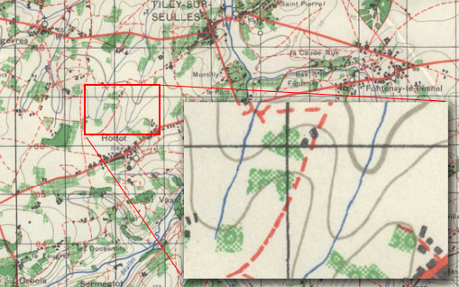 As the table is 4’x6′, that equates to a rectangle 1 x 1.5 map squares. This one is precisely lined up with the grid lines, but obviously they don’t have to be, and the direction of attack/major terrain features might imply a more appropriate orientation.
Once I had that, I screengrabbed the Google maps satellite photo of the same area. Having done a few comparisons of these with WW2 1:25,000 maps (which show all the field boundaries), the fields in existence today are very similar, although there has been a loss of quite a few of the orchards and hedges. Here the map has been overlaid with a 2′ grid.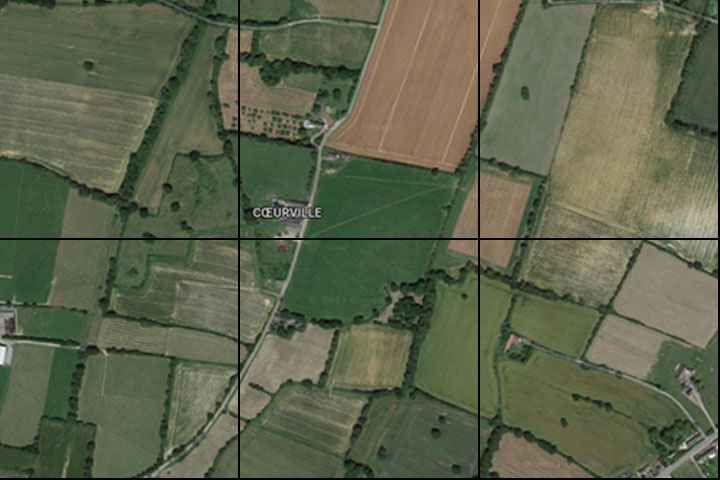
As you can see, even today the ’empty’ area of the map is full of small fields, hedges and ditches. Here’s a composite so you can see both together. They don’t align perfectly – the original map wasn’t completely accurate anyway. The light green map areas are orchards. They don’t appear to exist any longer, but the field boundaries seem to roughly align with the orchard locations, so we can see where they used to be.
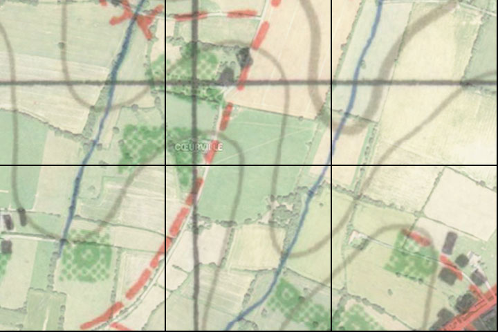
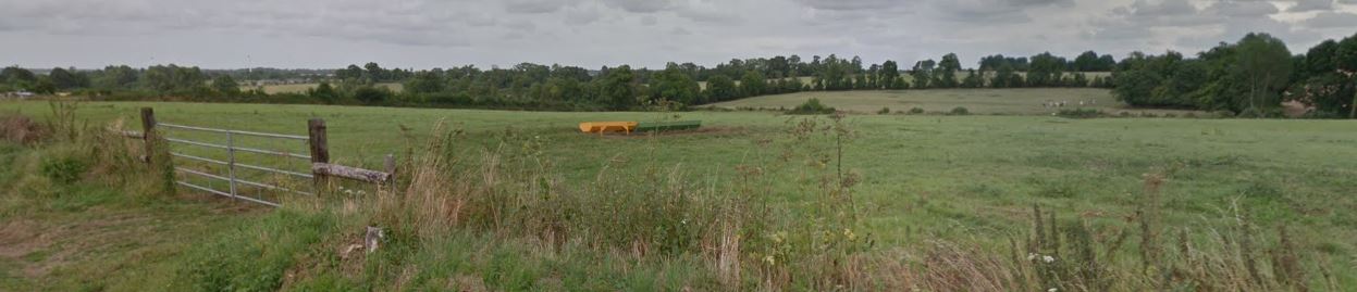
I then traced over it to create the ground in a “Crossfire” style. The streams here would be very small – barely more than ditches, so I haven’t bothered to depict them, other than putting a hedge down to represent the trees and scrub along the line of the stream. Likewise although there are some contours, I’m going to treat this as flat. Here’s a photo from the farm in the top-centre looking east towards the stream. Although the dip is perceptible and there is some ‘dead ground’ that can’t be seen because of the contours, I don’t think it needs a hill or contour line – the normal LOS rules would be sufficient to block this area.
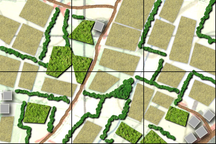
Here’s the final Crossfire map. It’s late June, so most of the fields have been counted as ‘in season’ which means they give cover and block LOS. The buildings have been translated into typical 3″ Crossfire building sectors. Each would represent, say, a farm and its outbuildings or a group of cottages and their surrounding gardens. Some of the villages were subjected to quite heavy bombing/artillery so some might be rubble instead.

Very nice maps Aidan. A nice combination of realistic and practical.